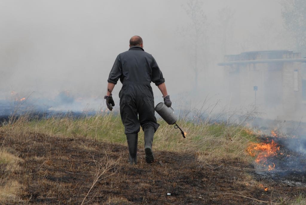
Controlled or prescribed burning is a technique used in forest
management, farming and prairie restoration.
Fire is a natural part of both forest and grassland ecology and
controlled fire can be a tool of hazard reduction. A controlled
burn conducted during the cooler months to reduce fuel buildup can
decrease the likelihood of serious hotter and more destructive
fire.
Controlled burning reduces fuels, improves wildlife habitat,
controls competing invasive vegetation, improves accessibility,
helps control disease and perpetuates fire dependent species.
|
Additional Hints (There are no hints for this cache)
Current at 11/6/2011
 7/8/2011 by Kabuthunk
Second cache of the day so far. The first cache I found had told me where I needed to turn (not that this was a particularly difficult, and this cache told me where I needed to park (ditto).
Rather peculiar, this cache. Since I hadn’t read the cache descriptions for any of these ahead of time, when I first stepped up I had no clue what this burn was from (assuming it was made from the controlled burn mentioned in the cache description). I pondered for a little bit as I walked up to the cache, wondering for a moment if it could have been lightning, but it was far too close to the ground. At that point my thought process was stopped by seeing the cache container lying directly on the ground, out in the open (well… the tree and whatnot are still hidden in the grasses, but it was in the clearing). Gotta say… so far the easiest find. And now thinking about the day afterwards, I’m pretty sure this was the easiest find for all of today  .
.
I wasn’t 100% sure where the cache was supposed to have gone originally, as there was potentially a few places that I spotted off the top of my head (assuming it wasn’t supposed to just be on the ground). I picked the most likely option and returned the cache to what seemed like a secure spot. On the plus side, this cache got me at least a little bit of shade, since up until now, all the way from the interpretive center, the drive here, and the first cache, it didn’t really look like I was going to have many opportunities to get out of the sun. So thankfully, this tree got me some nice shade out of the sun (although I soon discovered other oases of shade kicking around here and there throughout the day). Or at least I got to sign this one in the shade, which thankfully didn’t have many horseflies buzzing around me while I did that.
All that said and done, instead of returning to the car, I headed off down the trail to the next cache. At first I wasn’t entirely sure if I SHOULD be going this way, since I didn’t know if there was a separate ‘walking trail’ as opposed to ‘driving trail’. Throughout the course of the day however, I discovered that since this place is made for wildlife a lot more than for humans, it makes far more sense for there to be a generic road/trail combination, if not purely for utility purposes.
Two down, many to go!
Took: Nothing
Left: Logbook entry and chainmail ball
Nearby Caches
GC1BZ2Y Medicinal (0.16 kms E)
GC2X4N6 Marsh Management (0.59 kms E)
GC2X4KG North Marsh Cache II (0.69 kms E)
GC29VTC Wavey Creek (0.88 kms W)
GC1BZ2C Raptors (1.03 kms W)
GC2X4K8 Confusion and Diversion (1.88 kms SW)
GC2X4NH  Not your average marsh! (5.83 kms S)
GC2X4NM Dogwood (6.06 kms S)
Additional Hints (There are no hints for this cache)
 Burnt by OHMIC (1.5/1.5)
 Small Hidden on 5/28/2011
 Terrain:


