| Current at 11/6/2011 (Online waypoint URL) |
|
You have already found this cache! Master Index Nearest Caches  Old Kenora 1 - Harbourfront by moonsocket (2.5/1.5)
N49� 46.042 W94� 29.445 (WGS84) UTM 15U E 392650 N 5513832 Use waypoint: GC2NP0Z Size:  Micro Hidden on 2/11/2011 Micro Hidden on 2/11/2011
In Ontario, Canada Difficulty:  Terrain: Terrain: 


|
|
This is the first cache in the
Old Kenora Series
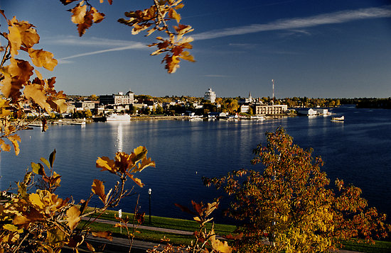
Kenora Harbourfront
Pre History of
Kenora:
Kenora's future site was in the
territory of the Ojibway when the first European, Jacques De Noyon,
sighted Lake of the Woods in 1688. Pierre La V�rendrye established
a secure French trading post, Fort St. Charles, to the south of
present-day Kenora near the current Canada/U.S. border in 1732, and
France maintained the post until 1763 when it lost the territory to
the British in the Seven Years' War — until then, it was the
most northwesterly settlement of New France.
Birth of Kenora's
"Harbourfront"
In 1836 the Hudson's Bay
Company established a post on Old Fort Island, and in 1861, the
Company opened a post on the mainland at Kenora's current
location.In 1878, the company surveyed lots for the permanent
settlement of Rat Portage ("portage to the country of the
muskrat")— the community kept that name until 1905, when it
was renamed to Kenora. The name, "Kenora," was coined by combining
the first two letters of Keewatin, Norman (two nearby communities)
and Rat Portage.
Kenora's
"Manitoba roots"
Kenora was once claimed as part of the
Province of Manitoba, and there are early references to Rat
Portage, Manitoba. There was a long lasting argument between the
two provinces known as the Ontario-Manitoba boundary dispute. Each
province claimed the town as part of their territory and the
dispute lasted from 1870-1884. Although Ottawa had ruled the town
part of Manitoba in 1881, the issue was finally taken up with the
Privy Council of England whom eventually decided in Ontario's
favour. Kenora officially became part of the province of Ontario in
1889. Boundaries were drawn up for the provinces and the Northwest
Angle on Lake of the Woods which definitively drew the borders
between Ontario, Manitoba, Canada, and Minnesota, U.S.A.
Kenora: Central to
Canada.
Gold and the railroad were both important in
the community's early history: gold was first discovered in the
area in 1850, and by 1893, 20 mines were operating within 24 km (15
mi) of Rat Portage, and the first Canadian ocean-to-ocean train
passed through in 1886 on the Canadian Pacific Railway. Later, a
highway was built through Kenora in 1932, becoming part of Canada's
first coast-to-coast highway in 1943, and then part of the
Trans-Canada Highway, placing the community on both of Canada's
major transcontinental transportation routes. The original barrier
to the completion of the highway concerned the crossing of the
Winnipeg River at two locations. The single span arch bridges are
among the longest of their type in North
America.
Kenora's Resource
to Tourism Transition.
Gold, minerals, wood, fish, and many
'resource aplenty'; Kenora began as a hub of resource
trade. The logging industry, which was important earlier, declined
in the second part of the 20th century as the tourist industry
grew, and the last log boom was towed into Kenora in 1985. In 2010,
the two largest mills in the community closed, and we demolished.
700 people, roughly 5% of the entire population, were laid off.
Kenora currently pursues and aggressive transition toward of
tourism and lifestyle economy.
Transformation of the
Harbourfront:
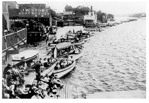
Always a tourist and recreation location, and famous
for sporting events like sailing, rowing: the Kenora harbourfront
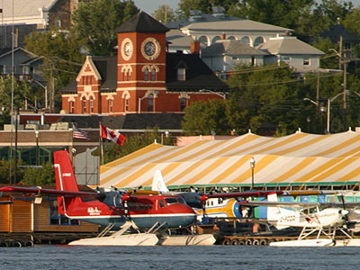
has always been a launch pad for exploring Canada's
wilderness, by boat, and then plane. The harbourfront has undergone
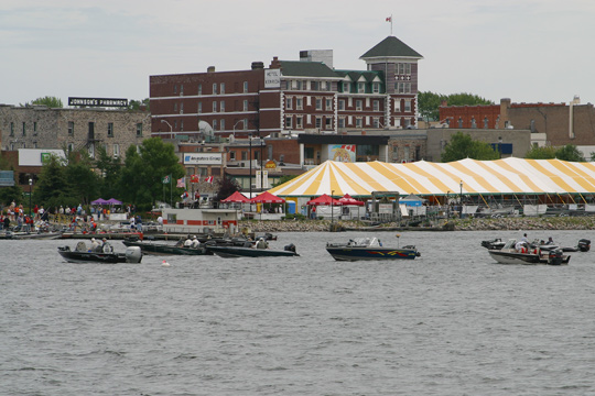
many redevelopments over the years. Most recently, major
reconstruction of the entire infrastructure has been undertaken.
Phase 1 occurred in 1986, and included the construction and
upgrades to the docking, parking, and the pavilion. Phase 2 is
currently underway, and is set to expand the docking ability of the
harbor, and create a more permanent infrastructure for the dozens
of events that occur down at the harbourfront each year. As well,
and more pedestrian friendly route from the harbourfront to the
tunnel island trails will be crated, among other upgrades,.
Kenora's harbourfront thrives, and will continue to do so
long into the future.
- Portions of text adapted from Wikipedia.org listing for "Kenora"
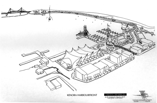
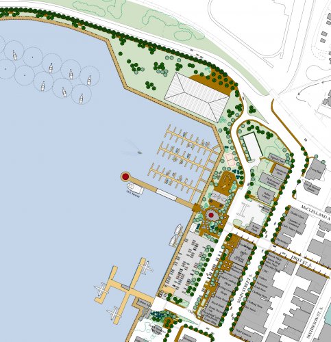
Phase 2 development plans

 . Hey, can't go wrong with that... it's like it was meant to be. So I quickly informed my wife of such, and began my hunt while she looked on. In the meantime, she soon got tired of looking at me comb the wall, and started to look at what shops are nearby.
 .
. .
. Cabin Lake cache part 1 of 2 (79.28 kms W)